Palm Canyon
January 17, 2012
Palm Canyon is an oasis in the desert. Aptly named for the palms which line this canyon like Native American braves awaiting battle.It is located at the end of Palm Canyon road. Continue going straight, avoiding the curve which leads toward Cathedral City. Eventually you will come across a toll booth. The entrance fee is $9 per adult. Stay to the left fork to find the Palm Canyon trail.
The palms here are the only native California palms in existence, and at one time their range extended up into Oregon. The palms were heavily used by the Cahuilla indians who made their home in the Oasis. The Cahuillas would eat the fruit of the palms, or grind it into a flour for cakes. The fronds of the palm were used for making sandals, baskets, and huts.
On this hike I took the short route. This is an hour and a half hike, about a 3-3 1/2 mile loop. The trail head lies next to the Trail Store. Take the Palm Canyon trail down through the oasis and picnic area. As the trail winds into the canyon, rock formations jutt up on either side. Cross the stream to the East side of the canyon and walk through the palm groves until it forks to the left. the sign says “Victor Trail.”
This trail is cut into the mountain side and reaches up and over the oasis, providing a great view of not only the oasis, but of Palm Springs and the windmills beyond. The mountain side is covered in barrel cactus, which is unique compared to most Coachella Valley hikes. The trail makes its way down the East side of the mountain and swing back around to the Oasis, then back up to the parking lot.
Desert Highway Danger
November 27, 2011
Desert highways are a danger which is rarely spoken about. Take a close look next time you’re on the highway, going through a long empty stretch of desert. Crosses line the road like billboards. They mark the final resting place of those who never made it home. I have a personal connection with this, as I lost my brother along Highway 62 in August of 2010. His SUV went off the road and rolled over the sand, crushing the top of the vehicle. Unfortunately this is all too common out here.
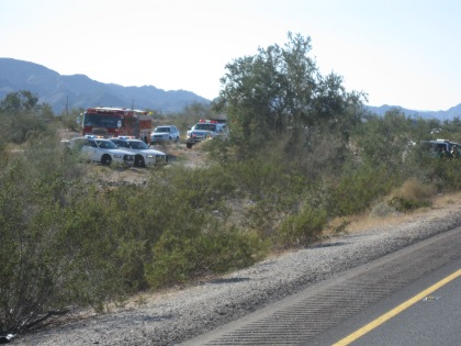
On my way home from a camping trip this afternoon, my brother’s last camp site in fact, I-10 slowed to a stop. Up ahead were police cars, fire trucks, and ambulances. Two crushed SUV’s lay on the side of the road, one was a Border Patrol vehicle, the other was a civilian SUV that had rolled and crushed like a tin can.
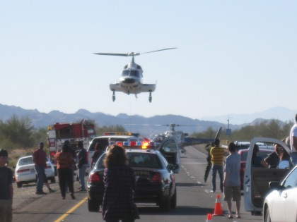
The sound of a helicopter flooded the air, and I knew this was bad news. The helicopter approached from the West, from the Coachella Valley. It landed in the center of I-10. Soon a second arrived.
I asked a passing police officer how many were injured. “Two,” he replied.
Everyone got out of their vehicles to watch the first responders work. The police told them to stand clear. One on looker reported that the Border Patrol had hit the SUV, an accident and not a chase. The Border Patrol vehicle’s hood was smashed in.
It was about 20 minutes before the helicopters took off. That’s a long time when people are so badly hurt. Hopefully the first responders were able to do their job and stabilized the two people. After the helicopters took off, they let us through.
15-20 miles down the road I noticed that the 2nd helicopter was circling. Then it landed out in the middle of the desert. There was no hospital there, only sand and bushes. I’m not sure what kind of problem they had, but it didn’t bode well for the injured person inside.
As hikers we concentrate on our outdoor skills. We focus on physical fitness, on staying hydrated, on our latest gear. We forget that sometimes the travel between trails can be just as dangerous as the hike itself. The road can kill just as the heat and rattlesnakes do.
Stay safe on and off the trail this holiday season.
Bump and Grind
November 23, 2011
The Bump and Grind is one of the most popular trails in the Coachella Valley, and it has now been cut short permanently by the California Department of Fish and Game (DFG). They have set up a gate near the top of the trail to keep hikers away from a prime lambing area used by the endangered Peninsular Bighorn Sheep.
This closure has produced an uproar throughout the Coachella Valley’s strong hiking community. Protestors have been posting themselves at the gate to remind hikers of their new limitations. Hikers are attending trail subcommittees to give the DFG and city officials their opinions.
The main argument of the hikers is that there have been no scientific studies on the disruption of the lambing area caused by humans, who hike within 1.2 miles. Katie Barrows, The Environmental Resources Director, responded to this at a town hall meeting. There is a plan in place to perform a similar study, however no funds are available. According to an article on Patch.com the plan would answer the questions:
- Do bighorn sheep avoid trails?
- What about activity and foraging patterns?
- Do recreation trails affect the population?
There has been scientific evidence that the presence of humans does in fact affect the endangered Bighorn Sheep, although none conducted specifically in this area. The DFG was asked whether the trail could be reopened following a study which showed that there was little human impact on the sheep.
“Remember we would also have to talk about not just the impacts of hikers on sheep in terms of going across the trails, but the impacts on the lambing area and if there was data that showed sheep would lamb with that many people there, we would consider it, but it would need to be definitive data,” said Kim Nichol Regional Manager of the DFG.
There is always a struggle between enjoying and impacting the outdoors. Many times it is cut and dry, however here there is no definitive evidence that an actual impact has been made. Is it right to stop taxpayers who own the land, and stay to the trails, from enjoying it? Or is it sensible to err on the side of caution when dealing with these endangered animals?
How do you walk the line between enjoying and impacting nature?
Graffiti and Pictographs
November 21, 2011
Corn Springs is a small campground about an hour outside of the Coachella Valley. This was once an Oasis in the center of a dry desert. At one time the water here would have attracted many Native Americans, namely the Cahuilla, as well as game such as rabbits, deer, and mountain lion. Later it would be an miner’s outpost. Today the campsite is meticulously clean and well kept.
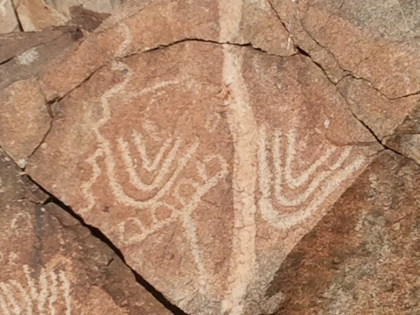
A local independent anthropologist invited me to see the pictographs that adorn the rocks around the spring. These pictographs are old, etched into stone by a people that lived hundreds if not thousands of years ago. These images are a window through time, a small clue to what these people thought and felt.
What first struck me about the images was that they were alongside the road. Usually pictographs are found far off the beaten path, where only 4×4 trucks containing avid hikers are likely to find them. This made the journey simple, and the pictographs were extremely clear, as you will see below.
A journey that is easy for us, is also easy for everyone else. Unfortunately not everyone has respect for these irreplaceable artifacts. What we saw next was disappointing to say the least.
The fact that people came out to this spot and left their mark in a permanent way shows a lack of respect. Not only did they leave their mark, but they destroyed marks left by a culture that has ceased to exist!
It is interesting to see that humans have a need to express themselves, no matter the culture or time period. Those who carved their name beside the pictographs must have felt much like the ancient Cahuilla did.
For those of you with any insight or opinions on this, I’m very interested in your comments below.
Beyond the pictographs and the campsite, we came across a dilapidated miner’s cabin. The miners were most likely searching out gold. Travelers came to express themselves here as well.
Future of Joshua Tree Uncertain
November 17, 2011
It was cool out yesterday as we hiked through Joshua Tree National Park in the high desert. The landscape was dotted with the unique trees, but for how much longer is uncertain. It seems that climate change has been hard on the species for thousands of years, according to a U.S. Geological Survey conducted by Ken Cole.
13,000 years ago lived a huge sloth which loved the flavor of Joshua Trees. The animals would eat the tree, and walk up to 10 miles before “depositing” its remains out in the desert. This provided the Joshua Tree seedlings with ample manure to grow healthy and strong. The sloth died out after the Ice Age, leaving the Joshua Tree seedlings without a ride and without a reliable food source. Unfortunately there are no modern day animals fit to play a similar role for the Joshua Tree.
Remains of these giants sloths were found in Gypsum Cave, 15 miles outside Las Vegas. The dung from the animals was found chock-full of leaves and seeds from Joshua Trees. The dung was so potent that travelers can still smell it within the cave, after 13,000 years.
Today, many desert animals rely on the Joshua Tree for survival. These animals made their home within the trees and drink the water from inside its hollow branches. The health of the desert can be measured by the health of the Joshua Tree.
“It looks from our modeling that Joshua Tree National Park and pretty much the southern half of the range would be too warm in the next 50 to 100 years to support Joshua trees anymore,” Cole said in an interview with NPR.
Climate Change could spell disaster for this species and those that depend on it for survival. It could also spell the end of Joshua Tree National Park, which would lose its main attraction. Some ecologists don’t think that Climate Change would cause the species to go extinct.
“There’s no question that a warming of the climate would reduce the suitable habitat for Joshua trees in the park — but not eliminate it,” Jim Cornett said in an interview with NPR. Cornett is an independent ecologist who has studied the Joshua Tree for 20 years.
Despite the debate, it would not be a bad idea to check out the Park. There are hikes, 4×4 trails, and some of the best rock climbing in the state. There is wildlife, Cahuilla Indian pictographs, and geological attractions to, including a volcano which never erupted. This is one of my favorite National Parks, as it has something to offer for everyone.
Endangered Big Horn Sheep
November 14, 2011

Big Horn Sheep are everywhere in the Coachella Valley. They are painted on signs, made into statues on medians, and on jewelry in downtown Palm Springs. The animal itself, however, is rarely seen. The Peninsular Big Horn Sheep has survived in the mountains since the Cahuilla Indians first hunted them generations ago. Now they find themselves on the Federal Endangered Species list.
There are less than 1,000 of these iconic mammals left in California. Only 65 reside in the mountains above Rancho Mirage, where the Bighorn Institute conducts their scientific research. The Bighorn Institute monitors these Big Horn populations by helicopter, and helps to supplement the herd’s numbers through captive breeding programs. Thus far 125 sheep have been breed and introduced into the wild population.
This is great news for the sheep. Their numbers have dwindled from disease, lack of offspring, predation by mountain lions, and the loss of habitat due to human activities. Golf courses and roads have intruded on the Big Horn habitat. Many sheep have been killed by vehicles, although the City of Rancho Mirage has since constructed a fence along Highway 111, keeping the animals off the road.
For those of you interested in viewing one of these endangered animals, the Living Desert has its own herd of Big Horn Sheep. Some of the more adventurous readers can hike along the back trails of Rancho Mirage and Palm Desert. Keep to the trails and remember to follow the Leave No Trace principles. Bring your camera and binoculars.
40,000 Acre Milestone
November 11, 2011
The Friends of the Desert Mountains has reached a new milestone. They now have 40,000 acres of land protected, set aside for conservation. To put this in perspective, 40,000 acres is the equivalent of Palm Springs, Indian Wells, and La Quinta combined. This is huge. The Friends of the Desert Mountains spent a total of $58.3 million to reach this milestone, and you can see how the land rings the Coachella Valley.
The incredible effort put forth is part of the Coachella Valley Multiple Species Habitat Conservation Plan. This plan is meant to unify the Coachella Valley conservation efforts and manage the interests of the conservationists and the developers of the region. The Coachella Valley is developing quickly. Developers want to build homes and install fields of solar panels for green energy. Despite the economic injection and the green energy produced, these land hungry initiatives are hurting the delicate desert ecosystem.
The Coachella Valley conservation plan aims to protect 27 species, 11 of which are on the endangered list. These species are spread out across 27 natural communities and on 1.2 million acres of land. The species include animals ranging in size of the Coachella Valley fringe-toed lizard to the Big Horn Sheep, both of which are endangered.
Name The Baby Giraffe
November 11, 2011
The female baby giraffe hit the dirt with a thump on Oct. 28th, 2o11. It was a five foot fall from its mother, but the baby giraffe was up and walking in just 30 minutes. The giraffe looked around its new home at the Living Desert in Palm Desert, CA. At 5’9″ it was dwarfed by the four full grown giraffes in the enclosure, which can grow up to 16 feet and weigh 2,800 lbs.
The Living Desert CEO Stacey Johnson added, “We could not be more ecstatic over the birth of this adorable giraffe calf. Giraffes are one of the most majestic and beloved creatures on earth. They are one of nature’s finest works of art – a combination of elegance, beauty and amazing architecture. It’s no wonder ancient prophets and poets considered the giraffe the ‘queen of beasts’. She will be a welcome addition to our giraffe exhibit.”
Well said, Ms. Johnson. She forgot to mention that these artful ‘queen of beasts’ are the tallest living land animal. They can hit speeds of 35 mph, and kill the ‘king of beasts’ with one kick of their mighty hooves. Their tongue is jet black and can be 21 inches long, used to pluck the high leaves of thorny desert plants. Choose her name carefully.
The Living Desert is allowing the public to name the baby girl. The one who submits the best name will receive a year-long Family Membership to The Living Desert, 4 tickets to their signature holiday event, Wildlights and get to meet the calf during a private giraffe feeding with their family.
Moss Points North
May 19, 2011
Which way is North?
It is common knowledge that moss usually points to the North, but what do you do if you see a rock like this? This rock has moss on three sides (all four actually, but I didn’t get the closest side in the picture). The top of the picture is actually North in this example, but it seems the East side has the most moss. There is a plant shading the right side of this particular rock, which is why this has happened.
Moss loves to grow in cool, dark places. Here in the Northern Hemisphere, the North side of trees and rocks are usually the coolest and darkest. This is because the Sun is located at the Equator, so light starts South and moves North. The Southern part of any tree, rock, or mountain is generally going to have the most light. Below is a my artistic representation.
Next time you are lost outdoors and you see a mossy rock, don’t make the assumption that the moss leads to the North. Take a look around. Are there any other factors influencing the amount of light your rock gets? Maybe the moss is taking advantage of a deep crack or a sheltering sand bank. Look around for isolated rocks or trees with moss, as the moss can only use the shelter from that object. Better yet, bring a map and compass!
Coyote Trail
May 19, 2011
I thought that I’d start my first blog post with the closest hike to my house. This hike is an old coyote trail that runs from my home down into Mias Canyon, just outside Banning, CA. I’ve kept it clear over the years, so has the Cal Fire inmate crew. It’s a short trail, but steep as hell! With about a 200 ft. elevation gain it’ll keep you in shape. It was overcast with some drizzle, which is the perfect time to see wildlife here in this arid region of Southern California.
Obviously I’m not the only one hiking today. This coyote scat was still relatively fresh. You can tell because as the scat ages it turns gray and this was dark black, plus it looked moist. I wasn’t about to touch it or to ruin my pen though. If you look closely you can still make out seeds embedded in there.
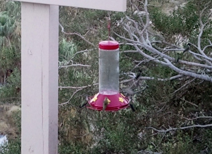
I’m no bird expert, but I looked this hummingbird up and it looks like its a Calliope Hummingbird, the smallest bird in North America! It lives in coniferous forests and wooded canyons. May-Sept. these birds are found in N, NE, and S California and the Sierras. April-May and July-Sept. they can mostly be found in S California.
Found this pack-rat home at the bottom of the trail, hidden under a big oak tree. Anyone have any clue what animal makes these? I don’t think pack-rat is the official name, but that’s what I’ve always called them.
Name- Coyote Trail
Time/Date- 1625 05-18-2011
Hdg- 114 degrees true
Round Trip- 465 ft.
Elevation- 3353 to 3153. 200 ft. Gain/Loss
Temperature- 63 F
Wind- NW 280 Degrees @ 8-12mph
Clouds- Cumulus 8/8 coverage
Barometer- 840.5
Other- Light drizzle


